
Cole Gold Mines
Exploring for high-grade gold in the prolific Red Lake Mining District
5,632.5-Metre Drill Program Completed
Rockland Resources completed its expanded 5,632.5-metre, 19-hole diamond drill program at the Cole Gold Mines Property. The program returned significant gold values in 12 of 19 holes, including results at the historic mine, Greg Smith Lake and Vein 15 targets.
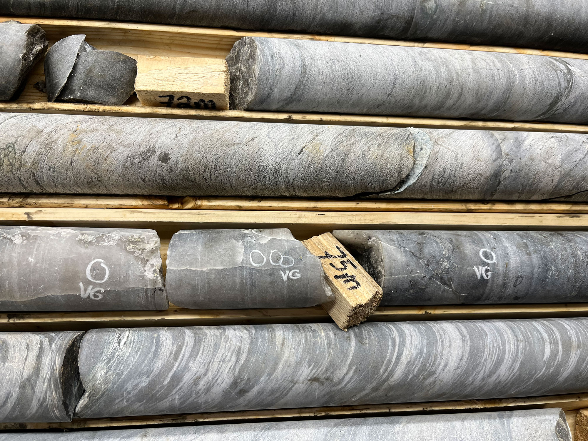 RR-26-02 at 75m (NQ Core)
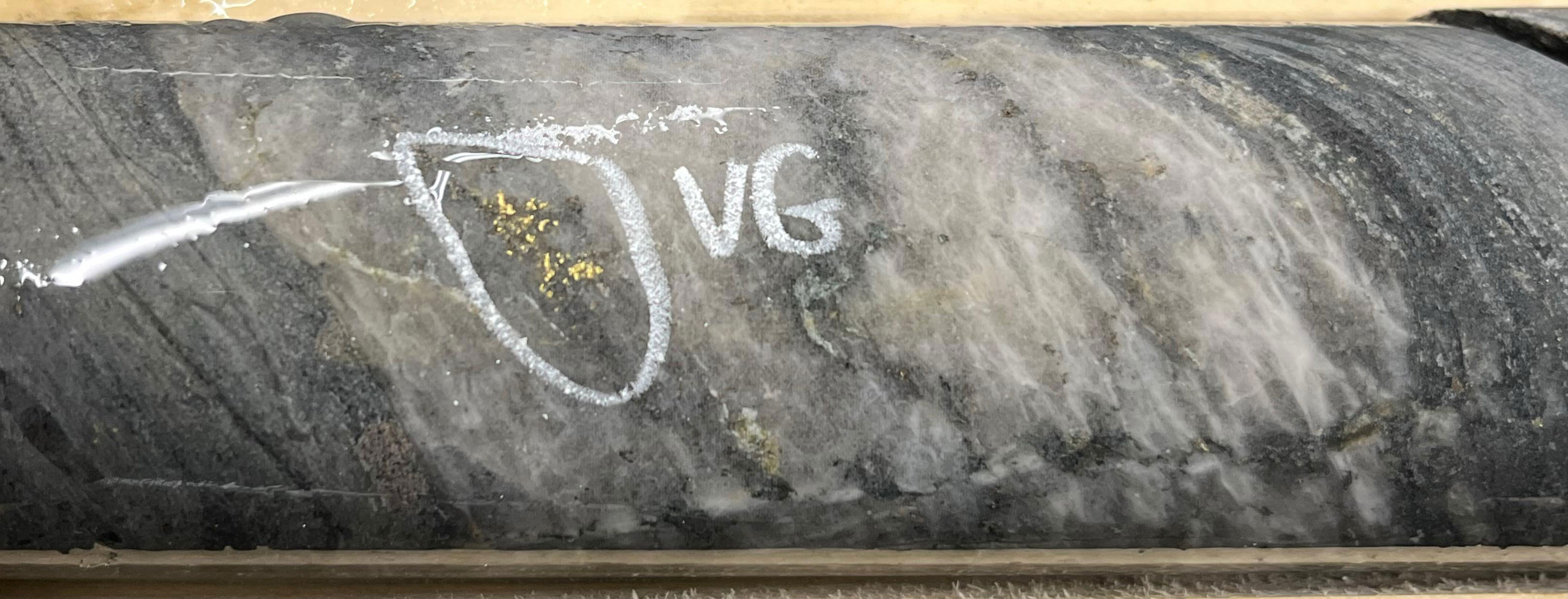 RR-26-02 at 187m (NQ Core)
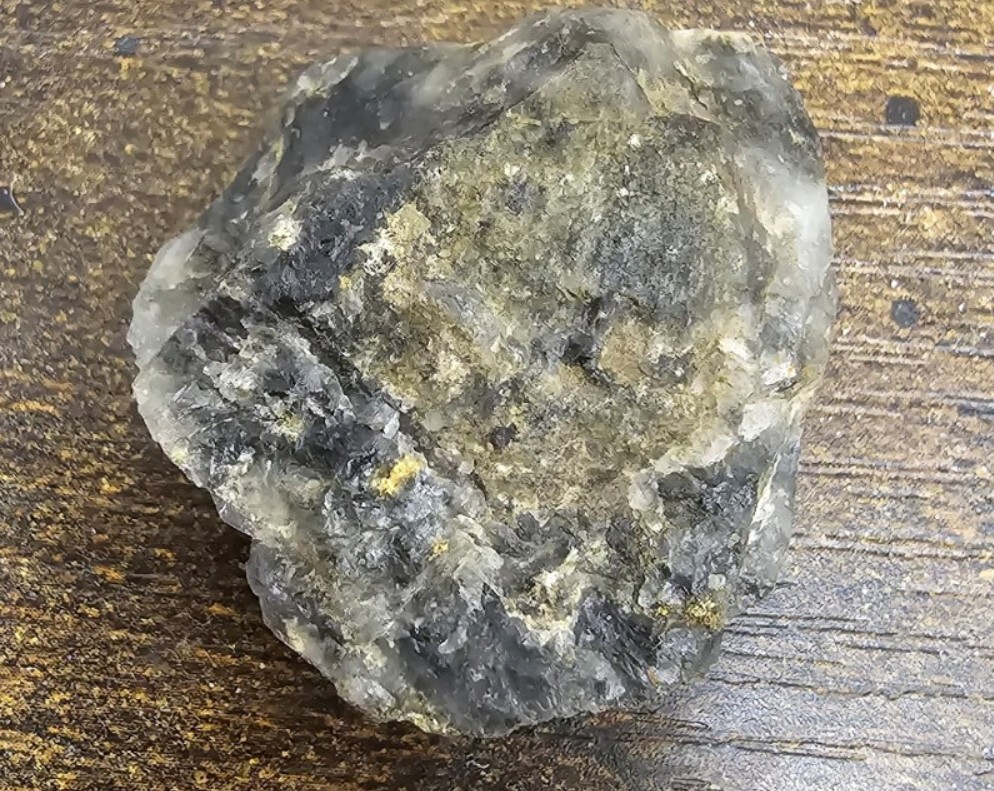 145 g/t Au Grab Sample — Visible Gold
Key Findings
What the Program Revealed
Cole Mine System Confirmed at Depth
Drilling confirmed the presence of the gold-mineralized vein system at multiple depths and orientations. Visible gold was intersected both within and below the existing historic workings, confirming that mineralization continues well beneath previously developed levels.
Gold mineralization is hosted within deformed quartz veins, veinlets and stockwork zones cross-cutting broad intervals of intense silicification — alteration envelopes that often extend over widths in excess of tens of metres in select holes. The system has now been drilled to greater depths than at any point in the property's history and remains open at depth.
GSL Zone — New Target Structure
The expanded 5,632.5-metre program included the first drill test of the Greg Smith Lake Zone. Hole RR-26-09 intersected 6.57 g/t Au over 2.50 metres, including 10.71 g/t Au over 1.50 metres.
This new zone was not previously documented among the property's known vein targets and demonstrates that the gold footprint at Cole extends considerably beyond the historic mine area.
Rheological Contact — Positive Results at Every Location
A key objective was to systematically test the rheological contact between ultramafic and felsic rock packages — a primary gold-trapping environment in the Red Lake district. Drill holes targeting this contact returned positive results at every tested location, including visible gold occurrences.
New vein systems — several previously undocumented on the property — were identified and are associated with broader alteration systems, with substantial widths in select intervals.
Buried Target Interpreted from Drone Magnetics
A drone magnetic survey over the Cole property and adjacent lake area identified a prominent magnetic low within a complex structural setting. Rockland interprets a possible buried intrusive source beneath Pipestone Bay; the magnetic target has not been drilled.
Together with the interpreted 4.5-kilometre-long structural corridor and newly identified alteration systems, the magnetic anomaly gives Rockland a larger area to rank for follow-up exploration.
World-Class Location
Red Lake Gold District
The Red Lake mining camp is one of the most prolific gold districts in Canada, having produced more than 30 million ounces of gold from 28 mines.
The Cole Gold Mines Property sits within the Pipestone Bay Deformation Zone, approximately 30 kilometres west of the Cochenour, Campbell, and Red Lake Mine Complex.
Neighboring Operations
 Cole Gold Property location within the Red Lake Gold District
A Rich Legacy
History of the Cole Gold Mine
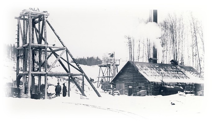
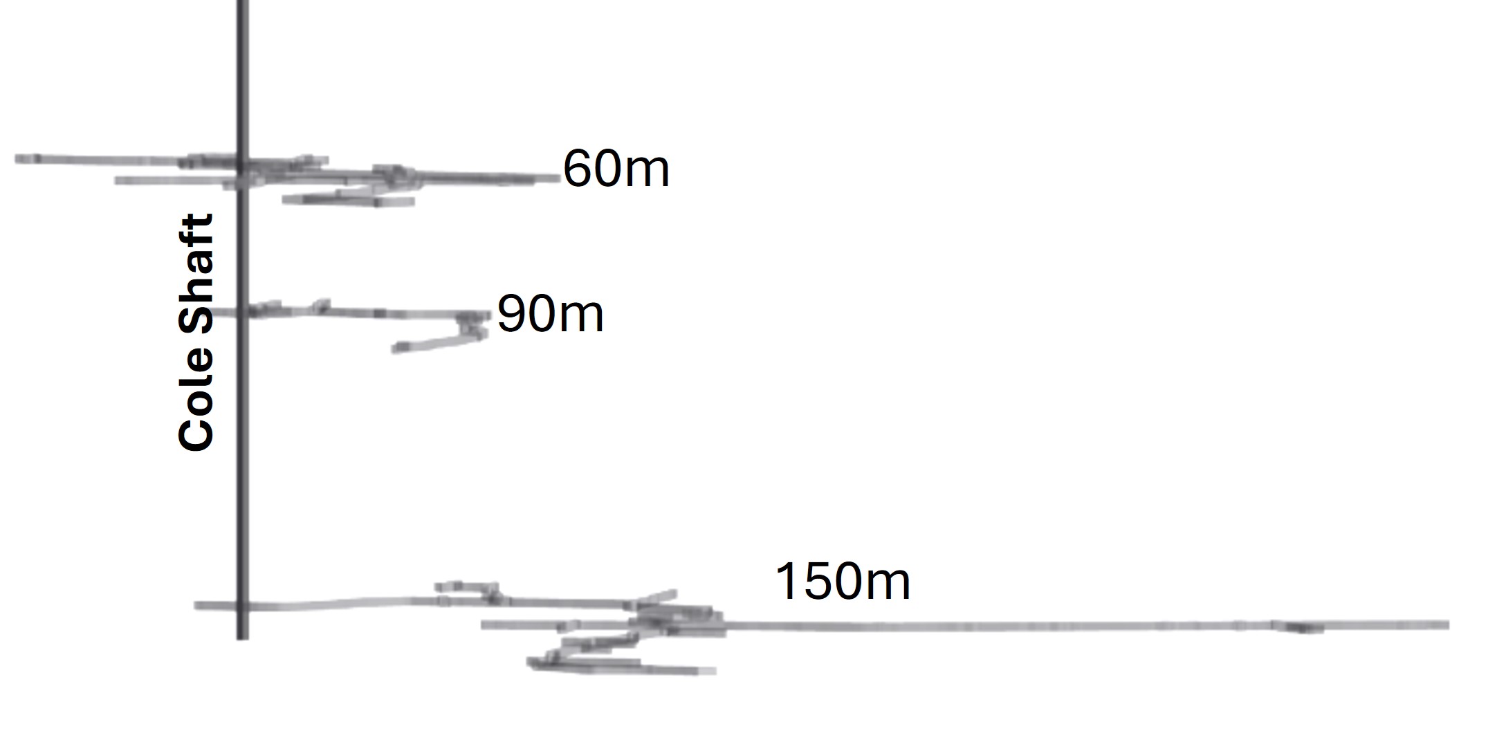
Exploration and mine development work was initiated by J.Y Cole, Jr, and subsequently by Cole Gold Mines.
By 1937, the shaft was deepened to 530 feet (161m) and additional levels at the 300-, 400- and 500-foot levels were established.
Cole Gold Mines Ltd (1926–1938) was active on the property with surface prospecting, stripping, mapping, trenching and sampling, identifying dozens of gold-bearing veins on the property.
The Cole mine is considered a non-producing historic gold mine. Aside from recovering gold from underground development, the veins at the Cole mine are still intact.
Exploration Focus
Vein Target Areas
Multiple vein targets have been identified on the Cole Gold property.
Target areas are defined by visible gold-bearing quartz veins that have been mapped and sampled on the property, historically (1930s-1970s) and recently (2020, 2021 and 2025).
Vein target areas are of similar size as the Cole mine target area.
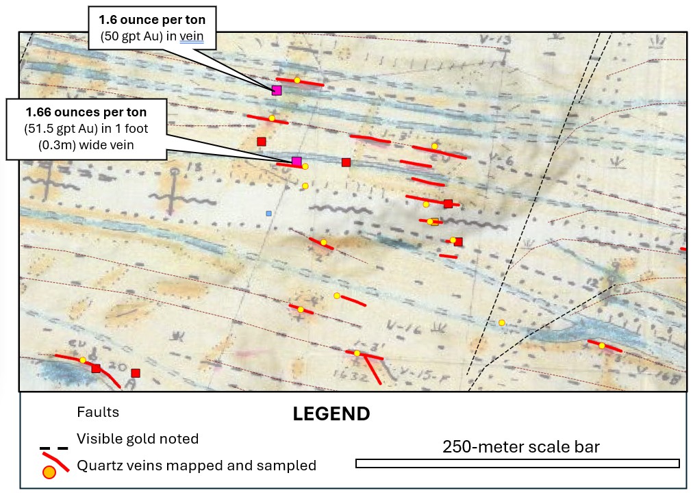
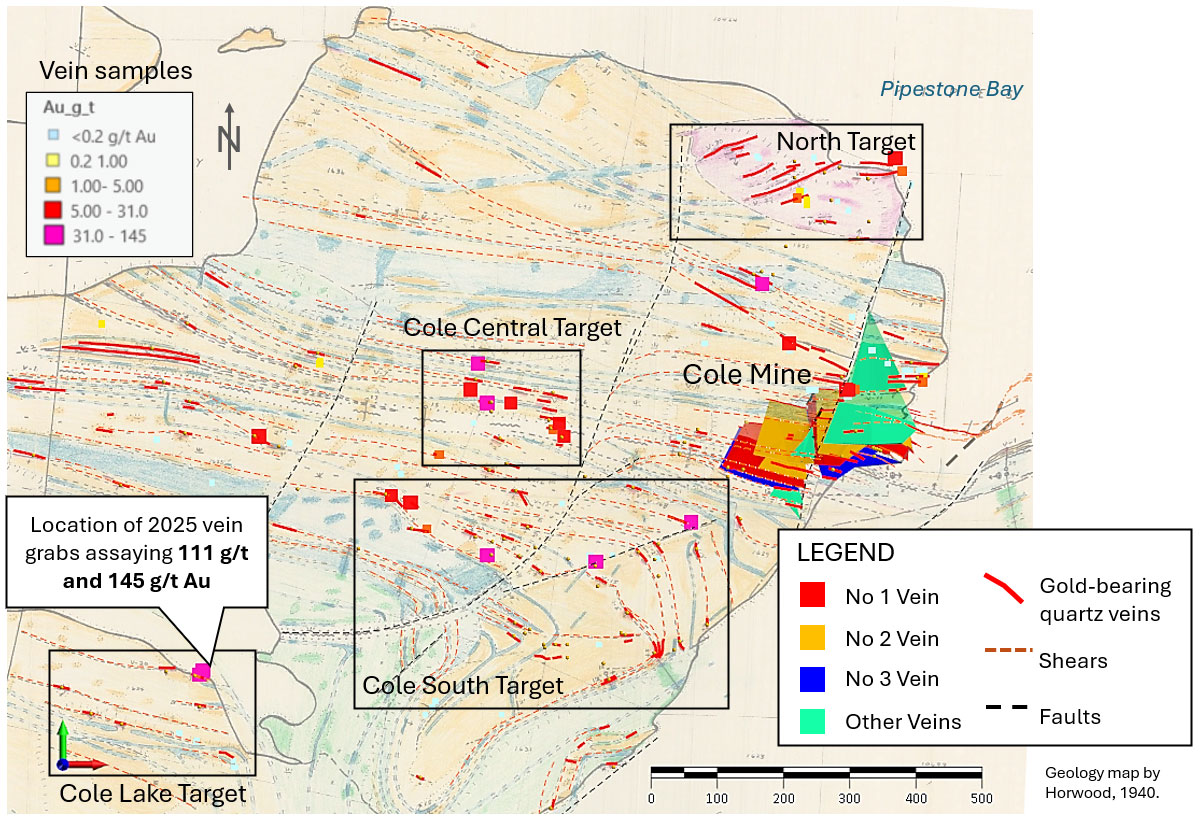 Geology map by Horwood, 1940
Cole Lake Target
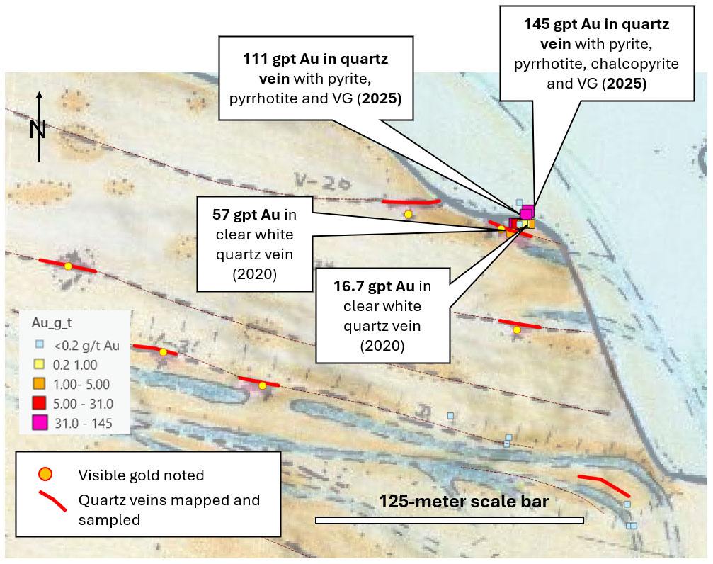
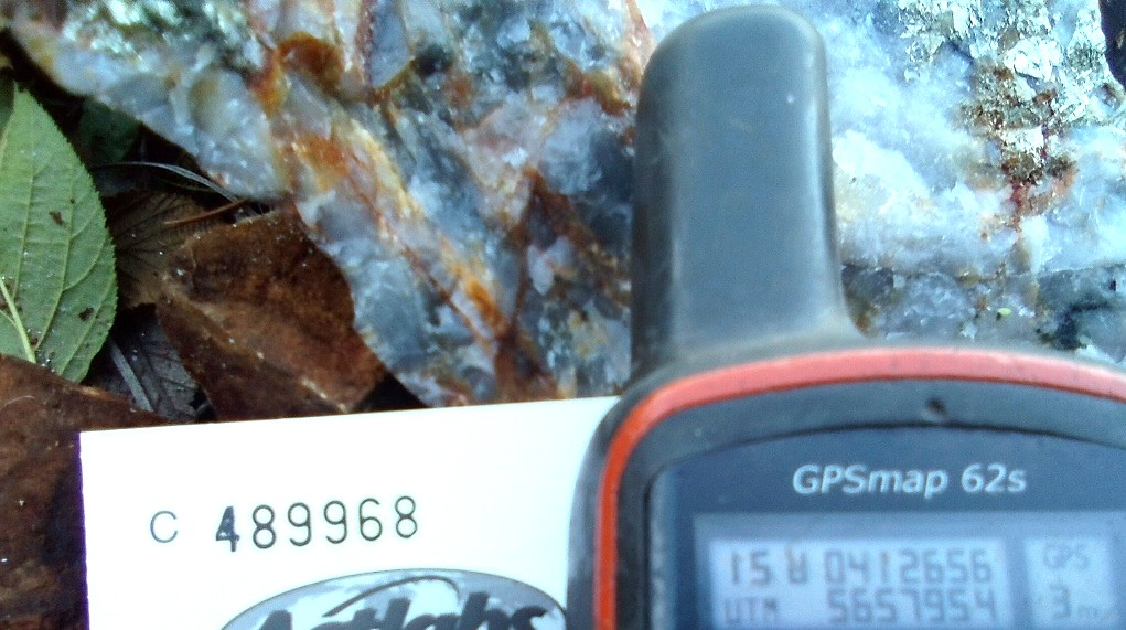
Two 2025 grab samples from outcrop of Vein No 20 returned gold by gravimetric results of 111 gpt Au and 145 gpt Au.
Veins are dark grey to smoky quartz.
This vein outcrop is 1 kilometer southwest of the Cole mine.
Cole Central Target
Historic mapping and sampling has identified multiple visible-gold-bearing quartz veins.
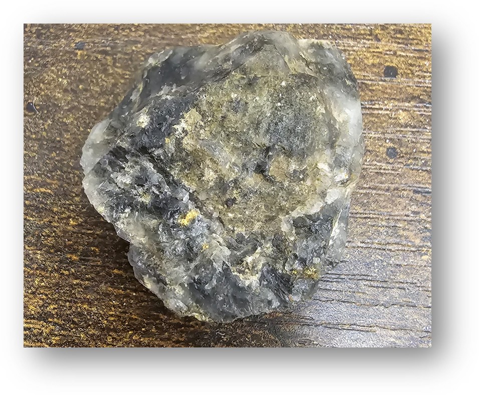 Coarse visible gold in smoky quartz vein grab sample from the Cole Property.
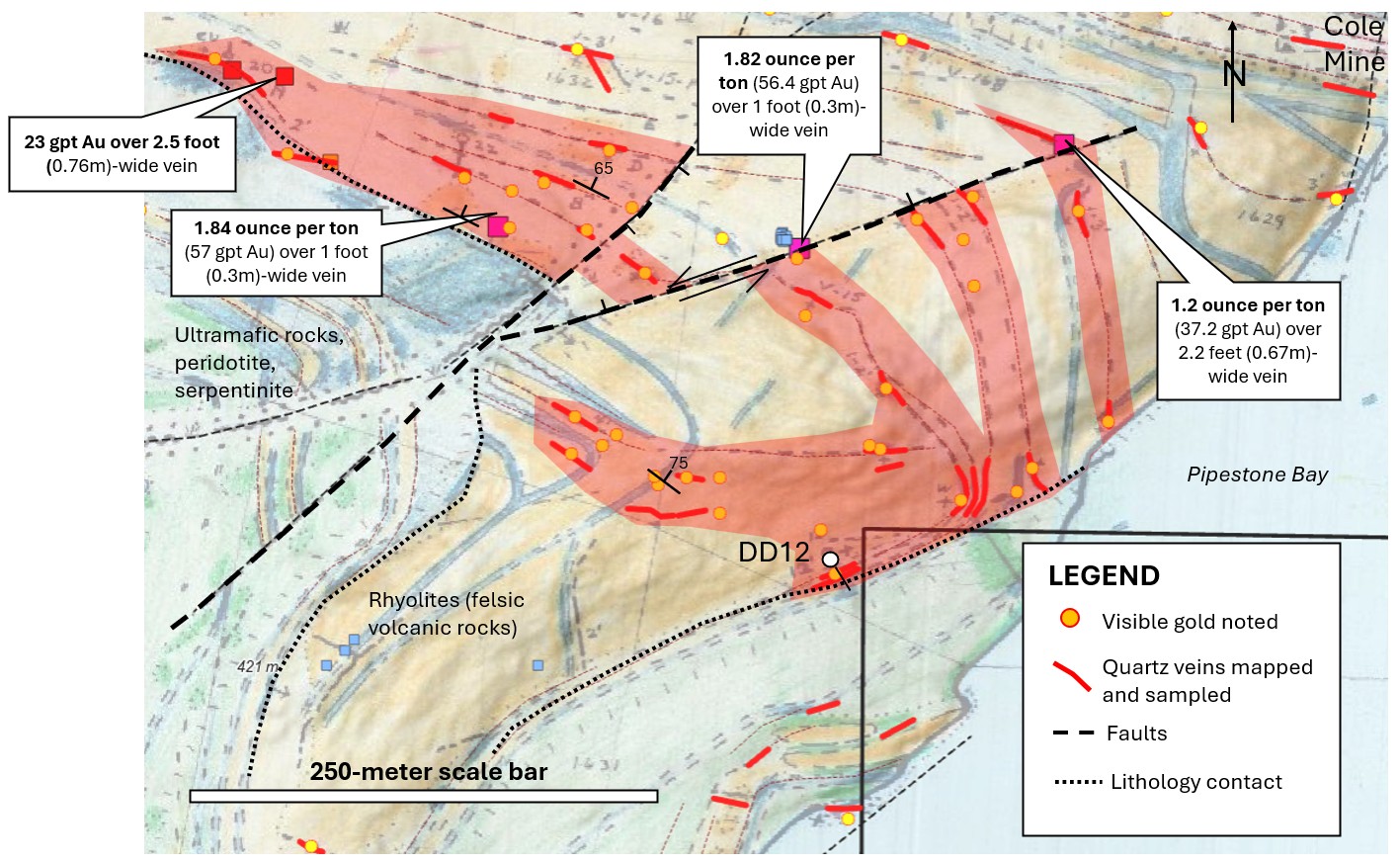
Cole South Target
Structurally and lithologically controlled gold-bearing quartz veins.
- More than 30 counts of visible gold
- Veins dip 65-75° to northeast, similar to veins at Cole mine
- Historic hole DD12 drilled into the sheared lithology contact: 4.7m wide, high-grade with 13 veins
- Cole South target is drill ready
Historic Hole DD12
Historic drill log for DD12 from 1930s Cole Gold Mining time was found in the local library.
Historic hole 12 intersected a steeply dipping, high gold grade, vein set, 4.7m true width and containing 13 veins.
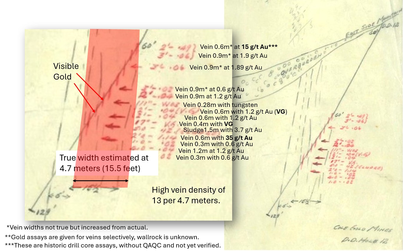 *Historic drill core assays, without QAQC and not yet verified.
Cole North Target
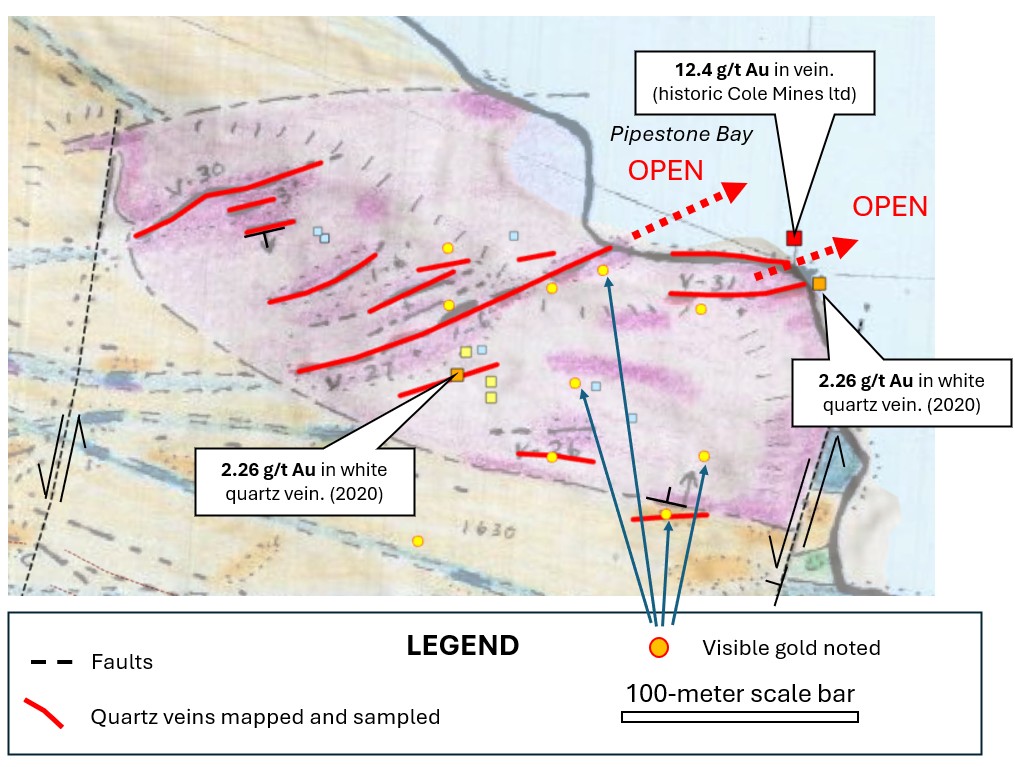
The Cole North vein target is composed of multiple subparallel quartz veins that are visible gold bearing.
Veins are hosted in an intrusive rock and controlled by two north-south trending strike slip faults. Vein widths were mapped in the range of 1-6 feet (0.3-1.8m).
Veins identified through historic mapping and sampling include Nos 26, 27, 30 and 31. Vein 26 dips north and vein 30 dips south.
The Cole North vein target area is 300m long by 200m wide and is open to the East, under Pipestone Lake.
Historic mapping and sampling has identified multiple visible-gold-bearing quartz veins located 400 meters North of the Cole gold mine.
Historic Discovery
Cole Gold Mine Underground
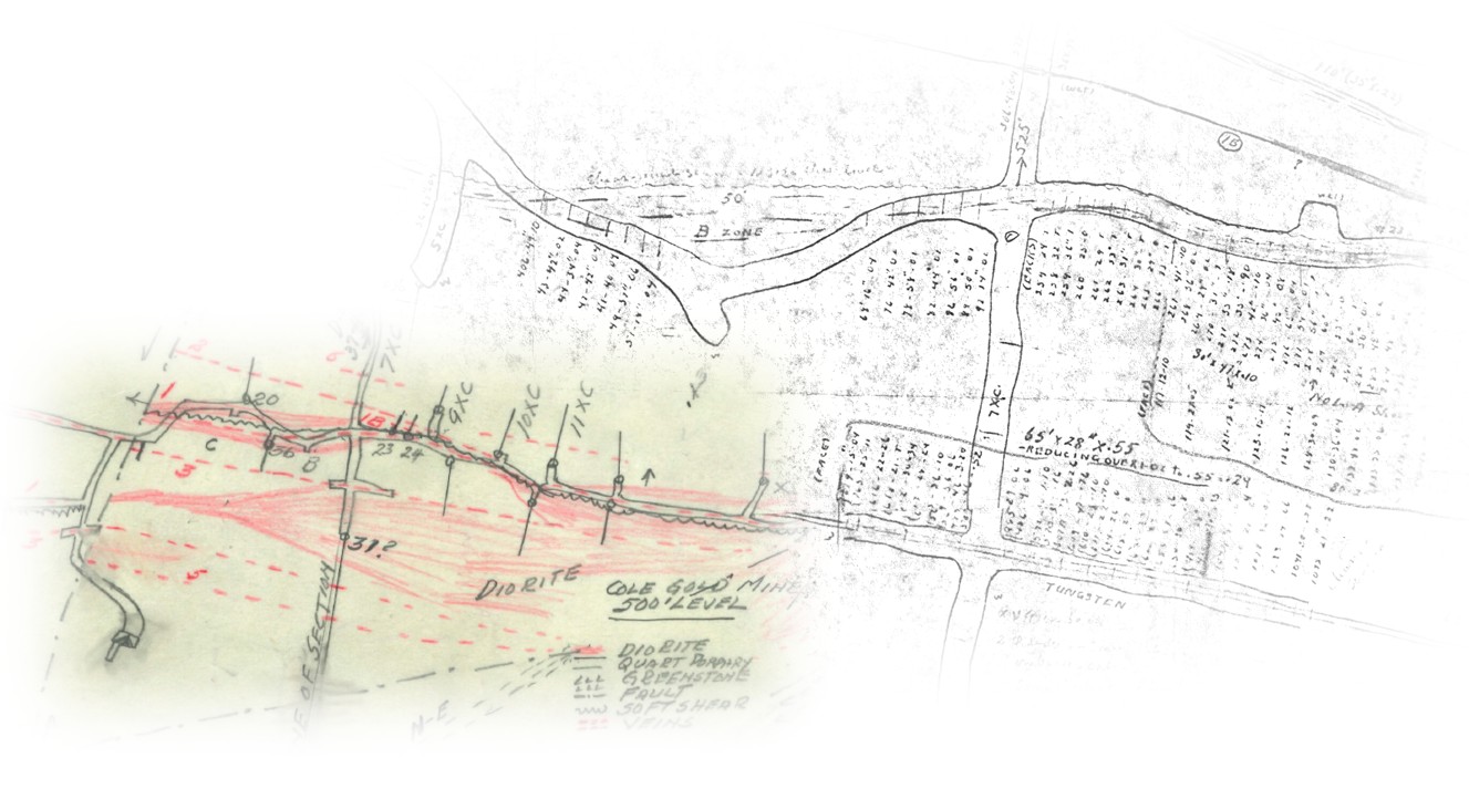
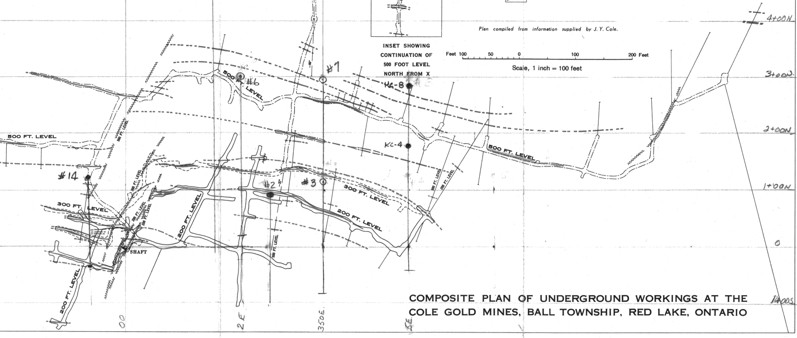
Underground mine maps and drill sections were recently found in a public local library in the town of Red Lake.
Kerr Addison did not have access to these maps. These maps were used to model the gold-bearing veins of the historic Cole Gold mine in 3D.
3D Gold Vein Model
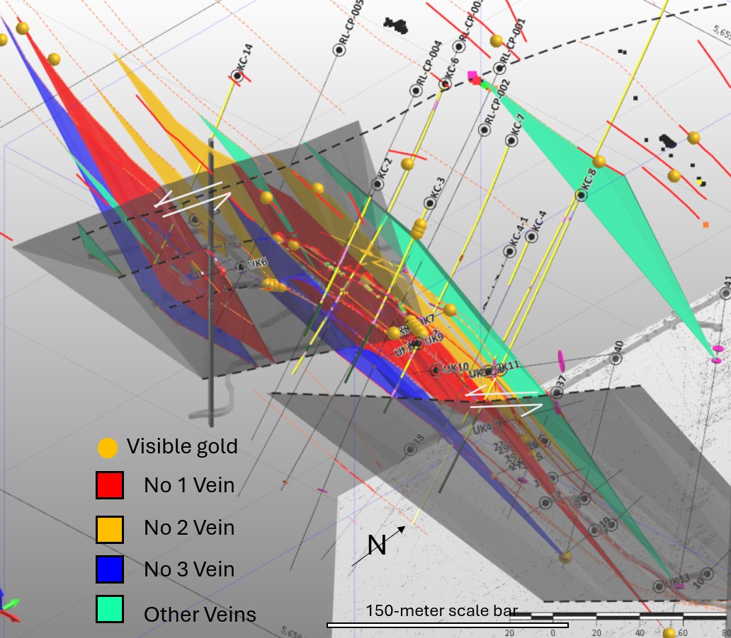
The underground gold-bearing vein system has been modelled in 3D.
Based on historical data, the veins at Cole Gold Mine extend 300-400 meters along strike and are around 0.6 to 1.2m in width.
The veins are controlled by two northeast trending strike-slip faults (grey planes) with vein offsets of around 30 to 50m.
Technical Data
Cole Gold Project: Veins 1, 2 and 3
The modelled veins at Cole Gold Mine must be re-drilled by modern methods, including insertion of blanks, duplicates and certified standards (QAQC) to get NI-43-101 compliant gold grades and widths for the veins.
| Vein Number | Strike Length (m) | Average Width (m) | Gold Grades (g/t Au) | Average Dip | Comments |
|---|---|---|---|---|---|
| No 1 | 130m west of main fault 250m east of main fault Total strike: 380m |
0.7 to 1.2 m (locally up to 1.72m) |
3.0 to 18.3 g/t Au* | 65-70° | Comprises at least 3 veins plus small spurs. |
| No 2 | 80m west of main fault 160m east of main fault Total strike: 240m |
0.6 to 1.1 m (widths up to 3m) |
2.6 to 12.7 g/t Au* | 65-70° | Located on north side of No 1 vein. |
| No 3 | 140m west of main fault 145m east off main fault Total strike: 285m |
0.6 to 0.8m | 6.2 to 17.1 g/t Au* | 65-70° | Located on south side of No 1 vein. |
*These numbers are non-NI 43-101 compliant and based on historic mine maps, lacking QAQC procedures.
Gold in Wallrock
Historic underground channel sampling was limited to veins.
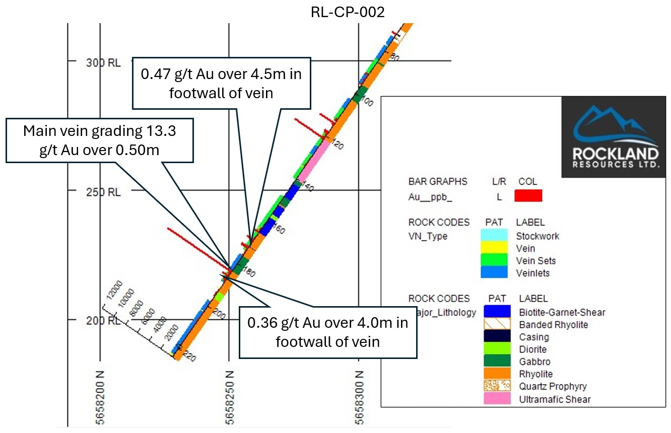
Wallrock carries gold as well as the veins.
2021 Drilling by Rockland shows additional, lower grade gold-mineralization in both the hanging wall rocks and footwall rocks of the main vein.
Exploration Potential
Depth Extensions
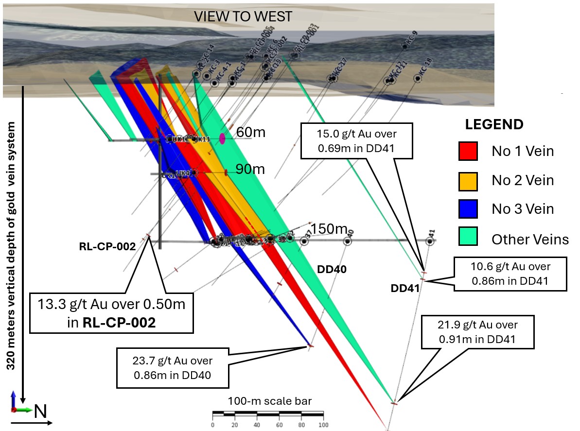
Historic underground drilling from level 500' (152m) shows veins continue at depth.
In 2021, Rockland Resources drilled 13.3 g/t Au over half a meter in hole RL-CP-002.
Total vertical depth of drilled gold mineralization is ~320 meters.
District Context
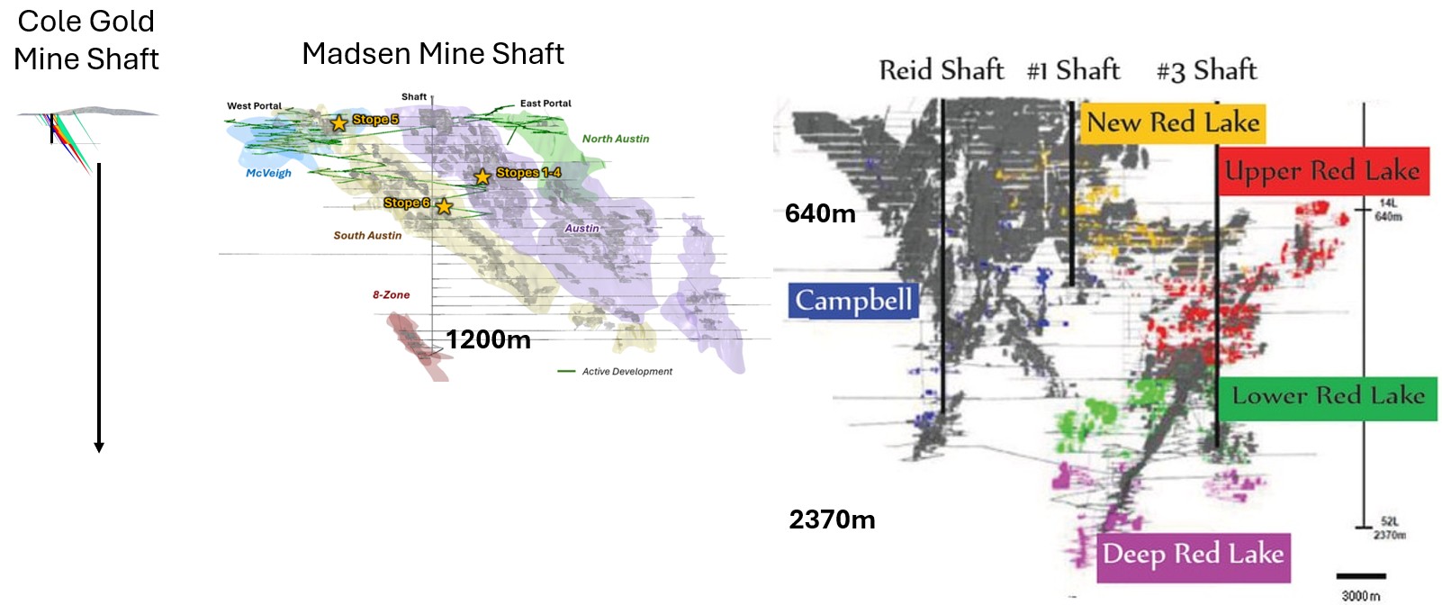
Depth of Gold Mines in Red Lake Gold District
Cole Gold Mine
Gold has been drilled down to a depth of 320m, with a lot of depth potential.
West Red Lake Gold
Madsen mine was historically mined to a depth of 1200 meters. Gold is drilled at a vertical depth of 1373m.
Red Lake Gold Mines
The gold mines in Red Lake Gold District continue to more than two kilometers depth.
Technical Analysis
Drone-Supported Surveys Targeting Lithology Contact
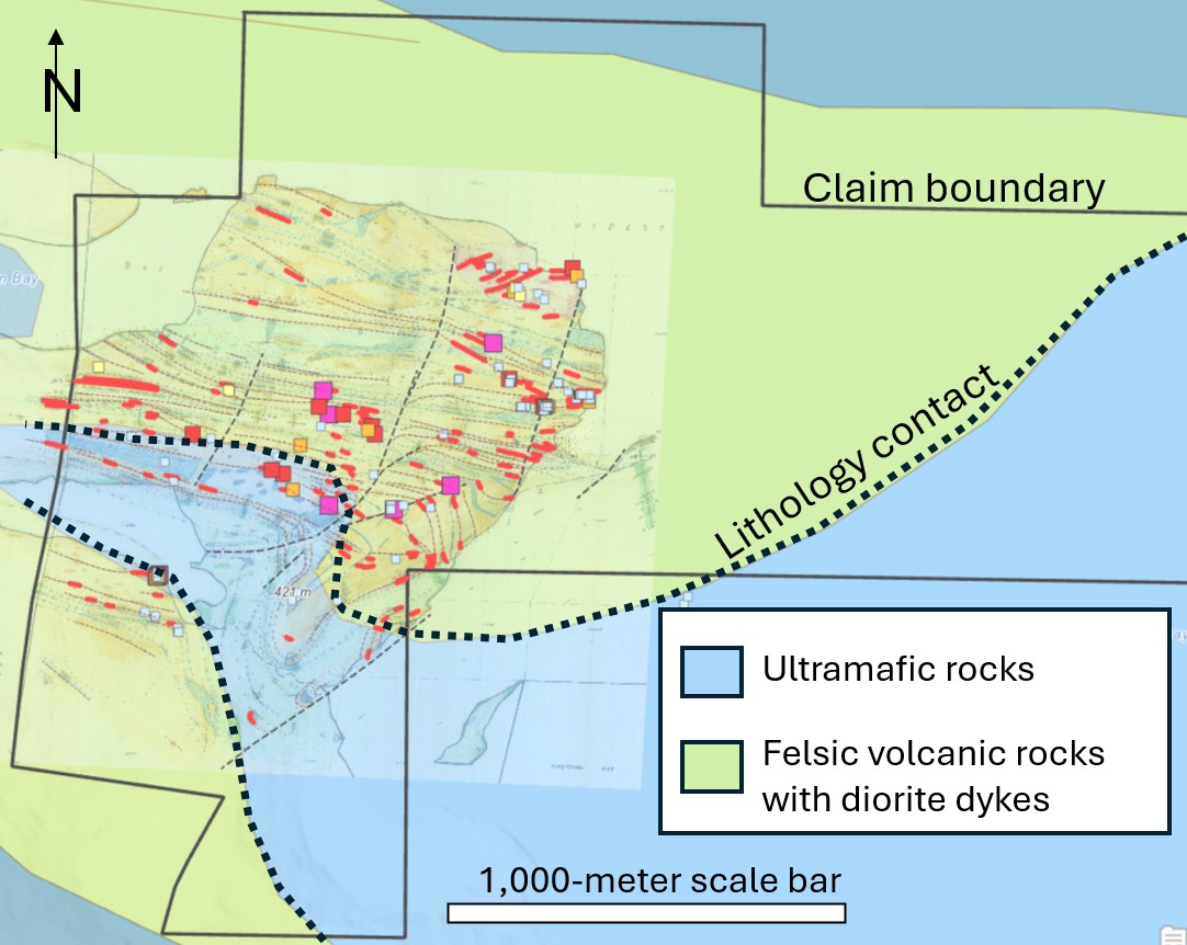
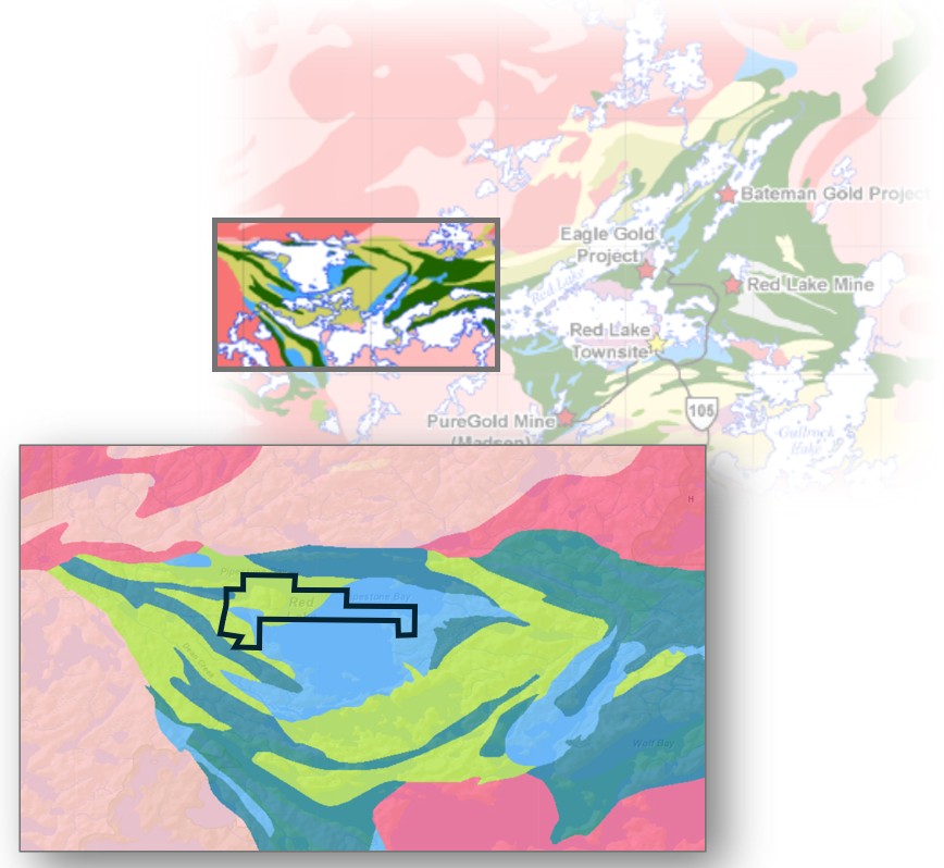
The Cole Gold Property is located in the pressure shadow of an ultramafic body that has intruded into, and been rotated by, a double-plunging fold system with a strong east-west trending shear following the fold axis.
Next Steps
2026 Exploration Plan
Drone Survey
Magnetics, TopographyDrone-supported magnetic, high-resolution orthoimagery and topography surveys → identify major structures and magnetic lows.
Diamond Core Drilling
5,632.5 metres · 19 Holes · Cole Gold Mines Property5,632.5-metre expanded diamond drill program successfully completed → 19 holes, significant gold values in 12 of 19 holes, assay results reported.
Program Assessment & Strategic Planning
Results Evaluated · Next Steps DeterminedResults from the completed program informed the next phase of target verification and drill planning.
Phased Target Verification & Drilling
Cole and Evolution Option GroundRockland's October 2026 plan starts with field verification and ranking of mineral occurrences. A planned drill phase includes follow-up targets at Cole and high-priority targets on the Evolution Option ground. Further work depends on results and Technical Committee review.
RL-COLE-26 Winter Drill Program Results
Rockland Resources completed the RL-COLE-26 winter drill program at the Cole Gold Mines Project, consisting of 5,632.5 metres of diamond drilling across 19 holes. The program returned significant gold values in 12 of 19 holes, with results including:
- 79.9 g/t Au over 0.50 metres near surface in hole RR-26-08 (screened metallic fire assay: 36.9 g/t Au)
- New drill-confirmed gold zone at Greg Smith Lake, approximately 1.1 kilometres southwest of the historic mine
- Gold mineralization in all three holes completed during the first drill test of the historically mapped Vein 15 quartz structure
- Approximately 775 metres of mapped Vein 15 strike remains untested by the current drill program
Vein 15: First Drill Test Confirms Gold-Bearing Mineralization
Vein 15 is a historically mapped surface quartz vein structure interpreted to extend for approximately 1,000 metres. Prior to the RL-COLE-26 program, Vein 15 had not been drill tested. Three holes were completed from two drill pads located approximately 225 metres apart along the mapped structure. All three holes intersected gold mineralization.
Eastern Vein 15 Target
RR-26-08 intersected 79.9 g/t Au over 0.50 metres from 23.65 to 24.15 metres downhole, at approximately 20 metres vertical depth. Screened metallic fire assay of the same sample returned 36.9 g/t Au. Using the screened-metallic result, the high-grade sample forms part of a broader mineralized envelope grading 3.1 g/t Au over 6.85 metres, including 19.4 g/t Au over 1.0 metre.
Nearby hole RR-26-07 intersected 8.11 g/t Au over 0.25 metres from 54.29 metres downhole (screened metallic: 5.25 g/t Au).
Western Vein 15 Target
RR-26-15 tested the western portion of Vein 15, intersecting several separate gold-bearing intervals from shallow depth to near the bottom of the 500-metre hole.
Highlight results include:
- 11.30 g/t Au over 1.85 metres from 39.0 metres downhole
- 6.23 g/t Au over 1.61 metres from 150.39 metres downhole
The drilling confirms that Vein 15 and its associated altered and structurally prepared corridors carry gold within the tested area. Approximately 775 metres of the mapped structure remains untested, providing a substantial area for follow-up exploration.
Greg Smith Lake Zone: New Bedrock Gold Discovery
The Greg Smith Lake Zone was identified by Rockland prospectors in 2025 along the shore of Greg Smith Lake, approximately 1.1 kilometres southwest of the historic Cole mineshaft. Previously reported selective surface grab samples from the area returned values of 111 g/t Au and 145 g/t Au.
The RL-COLE-26 program provided the first drill test of the target. RR-26-09 intersected 6.57 g/t Au over 2.50 metres from 110.0 metres downhole, including 10.71 g/t Au over 1.50 metres from 111.0 metres. The mineralized interval is hosted by a quartz vein within andesite and confirms that significant gold mineralization continues into bedrock beneath the surface discovery area.
The discovery expands the known distribution of significant gold mineralization across more than one kilometre of the Cole property.
Developing Geological Model
Detailed logging from the RL-COLE-26 program indicates that gold mineralization occurs in several related geological settings:
- Western Vein 15: Multiple high-grade intervals occur directly across contacts between felsic volcanic or felsite rocks and mafic dykes.
- Eastern Vein 15: Near-surface high-grade gold occurs within an altered and quartz-veined andesite sequence immediately below an ultramafic-gabbro-andesite transition.
- Greg Smith Lake: The principal gold interval is hosted by a quartz vein within andesite.
The results support a developing model in which gold deposition was influenced by a combination of:
- Structural preparation
- Quartz veining
- Silica-sericite alteration
- Sulphide mineralization
- Competency contrasts between adjacent rock units
- Selected lithological contacts
Scheelite was logged in varying amounts throughout the drill program, commonly within altered or veined intervals. Further geological and geochemical work is required to determine whether tungsten-bearing alteration has a consistent spatial or genetic relationship with gold mineralization.
Pipestone Bay Option Agreement
Rockland has signed a definitive earn-in agreement with Evolution Mining Gold Operations Ltd., a subsidiary of Evolution Mining Limited (ASX: EVN). It gives Rockland the opportunity to earn up to 70% in the Evolution Option ground surrounding Pipestone Bay. Rockland's Cole Gold Mines property remains 100%-owned.
Approximately 3,471-Hectare Footprint
The agreement provides the opportunity to expand Rockland's Pipestone Bay exploration footprint from 608 hectares to approximately 3,471 hectares, or about 5.7 times the starting area. This combined footprint includes the Evolution Option ground; the 608-hectare starting figure is not the total Cole property area.
Up to 70% Interest
Rockland may earn 51% in the Evolution Option ground by funding C$5 million of exploration over three years and issuing 250,000 shares on the agreement's schedule. After earning 51%, it may increase its interest to 70% by funding at least another C$6.5 million over a further 30 months and issuing another 250,000 shares.
Rockland was appointed operator when the agreement was executed. These interests remain to be earned.
Historical Occurrences & Untested Target
The Evolution Option ground hosts 30+ documented historical gold occurrences. An interpreted magnetic anomaly beneath Pipestone Bay measures approximately 1,050 by 625 metres in plan view; its interpreted source remains untested by drilling. Historical results have not been verified by the Qualified Person and should not be relied upon.
If Rockland defines an NI 43-101 resource of at least 1.5 million ounces gold equivalent, Evolution may increase its interest to 70% by paying 150% of the relevant proportion of Rockland's resource-defining exploration expenditures; Rockland would retain 30%. A contemplated joint venture would give Evolution a right of first refusal to process project ore on commercial terms, subject to available capacity. These are conditional rights, not a current resource or guaranteed processing access. Read the full October 2 release.